Those local to the Staunton-Augusta-Waynesboro area will be familiar with the mystique of Basic City. One of the more intriguing “lost cities” in Virginia, Basic City’s rapid development and sharp decline adds to its allure for history lovers. After the rapid decline came much slower decline, as industry moved away from the city. This decline culminated in Basic City’s 1924 merger with Waynesboro, which was not a smooth one. Subsequent development and a series of demolitions and fires have left only a handful of dilapidated vestiges of the once thriving city.
While this blog primarily focuses on threatened architecture within Augusta County proper, the appeal of Basic City was too strong. Additionally, it should be noted that Basic City was legally part of Augusta County until 1948, when Waynesboro gained “independent city” status.
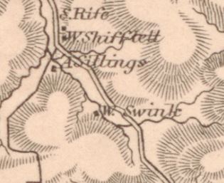
This installment will focus primarily on the Basic City landscape at the time of Jedidiah Hotchkiss’s 1885 Illustrated Historical Atlas of Augusta County. For those unfamiliar, Hotchkiss was the cartographer for the Confederacy during the Civil War. Many of his Civil War-era maps are hugely valuable resources for historians, and his 1885 map of Augusta County is a treasured resource. Hotchkiss was also closely involved in various early industrial speculation in Basic City during the 1880s and 1890s.
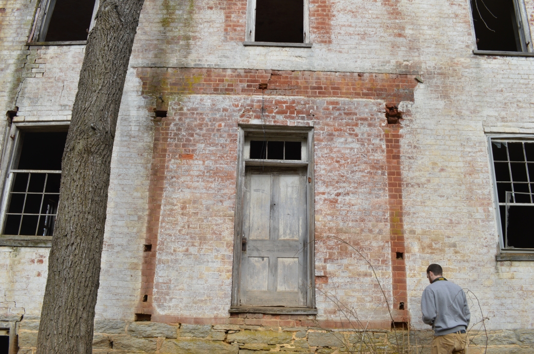
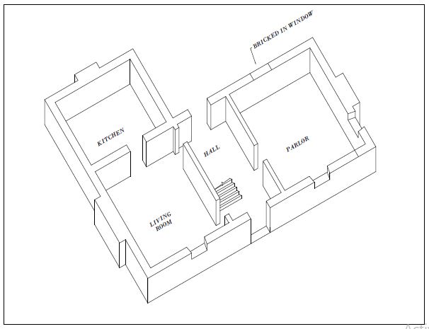
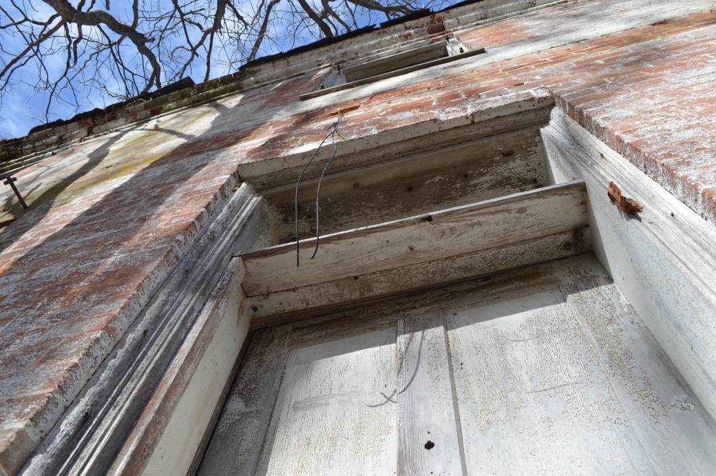
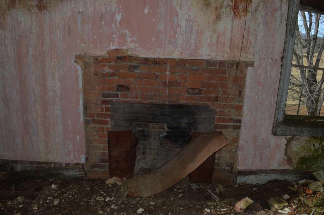
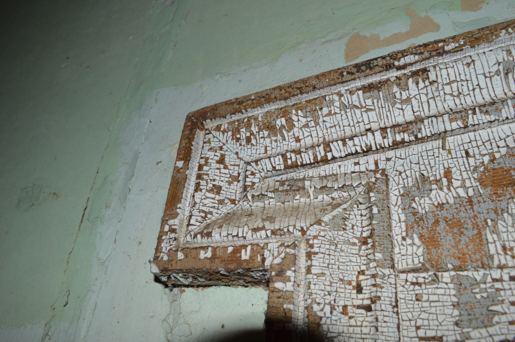
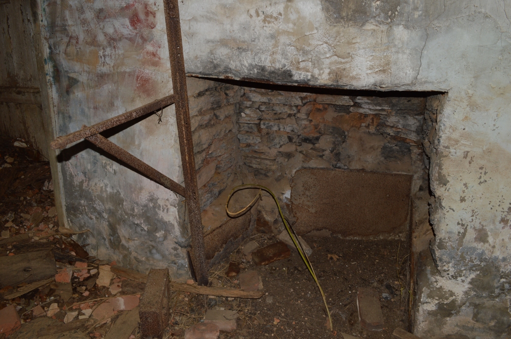
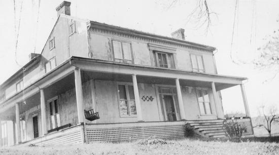
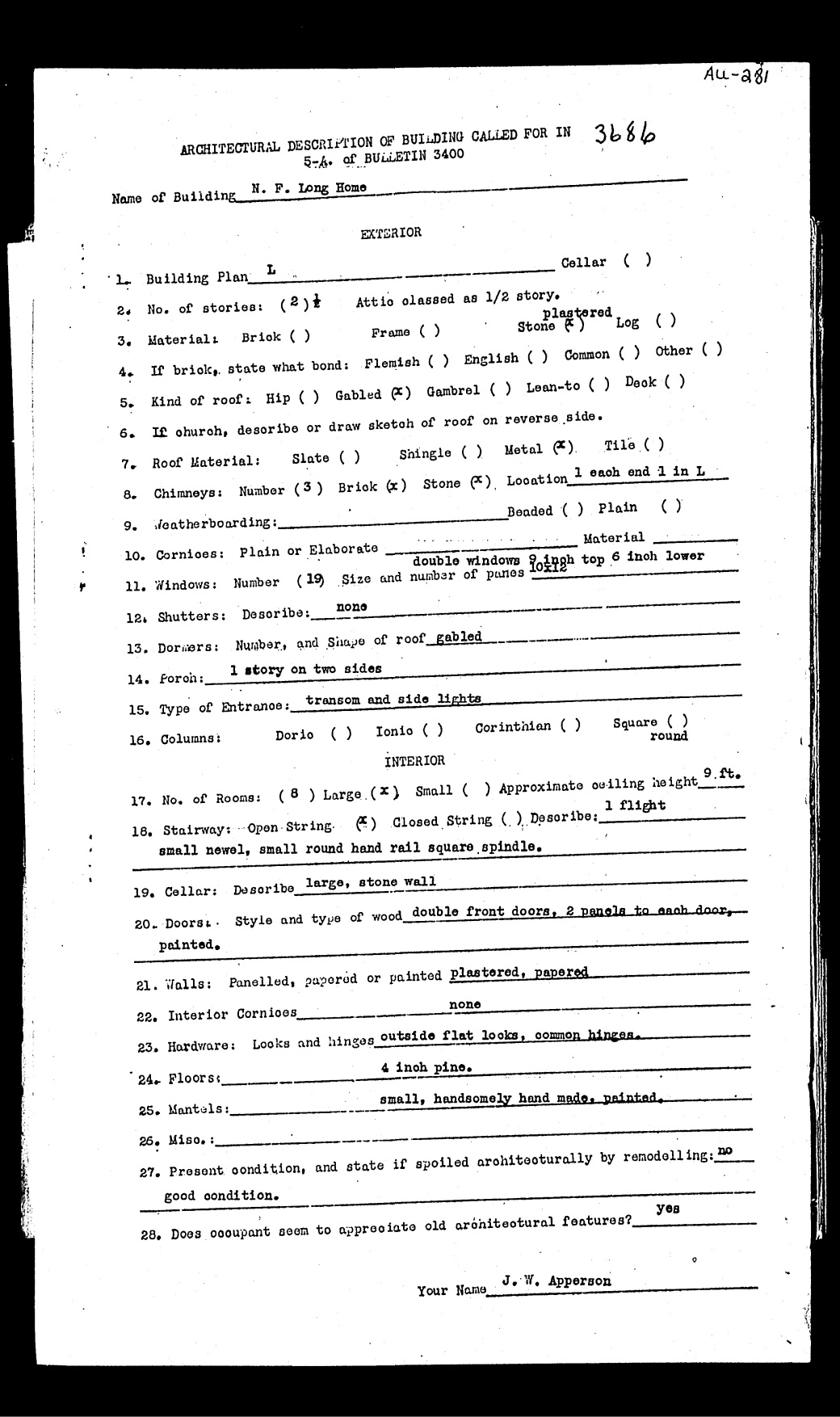
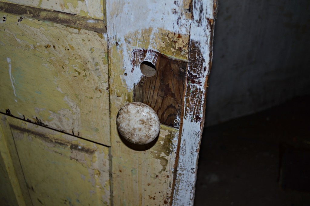
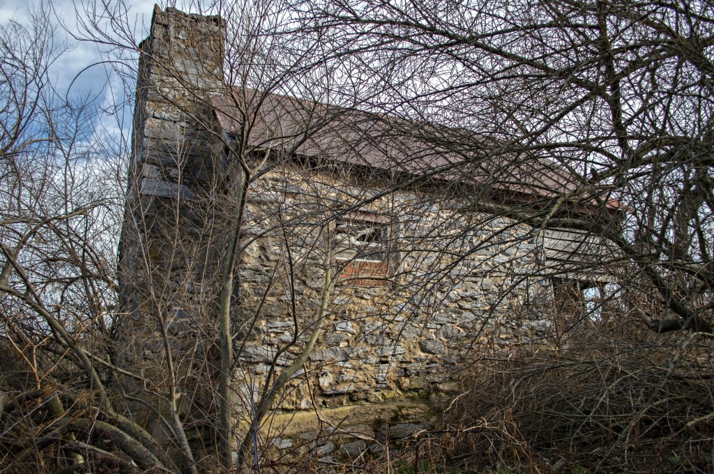
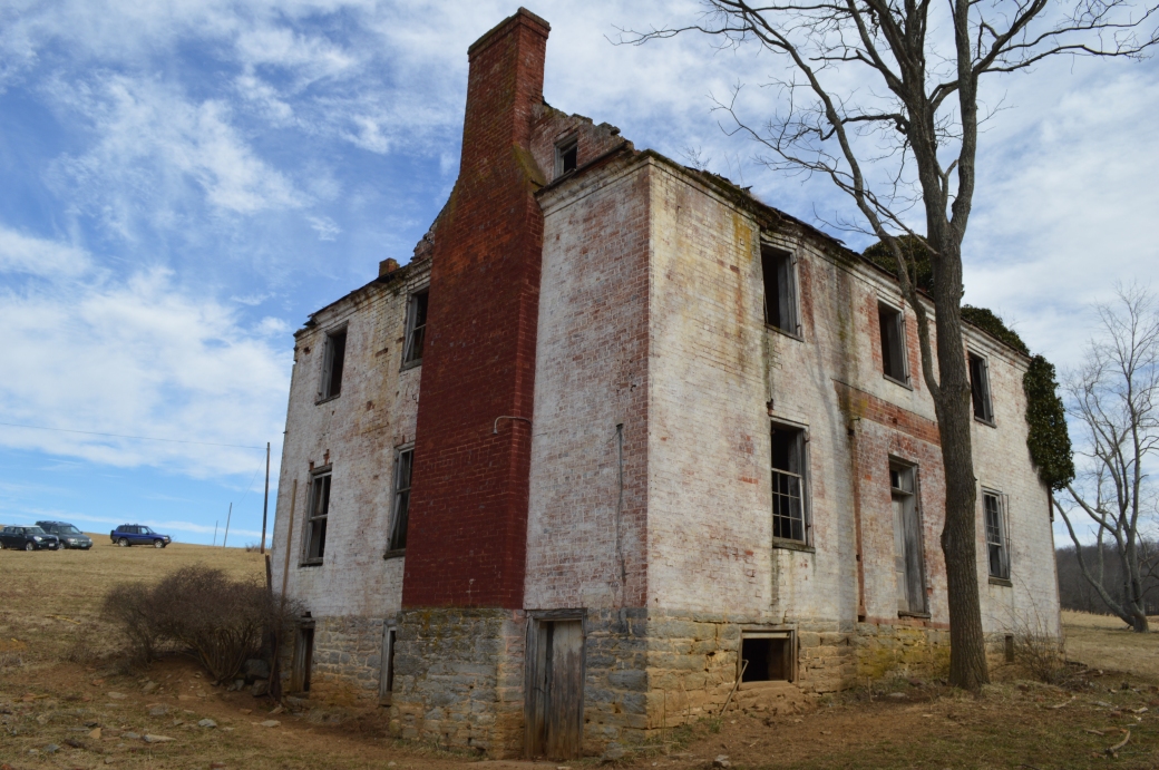 About a month ago, the crew braved the cold once again to explore one of Augusta County’s lost architectural gems, this time near Newport. The Sproul House (as we are referring to it) sits beside a stream away from any kind of established road, and comes complete with some original features and a couple of dead cows (which was somewhat unexpected). The house was of particular interest for us, because it appears that it had never been surveyed before.